The canal that is a lake (and also a reservoir).
How water underpins the Panama Canal's management.
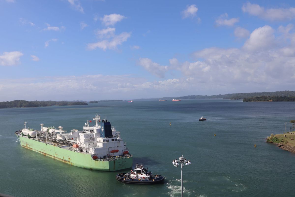
Panama marks the point where the sprawling masses of North and South America funnel inward to a minuscule strip of land. At its thinnest, the isthmus is just 50 kilometers across, compared to the 4,500 kilometers of the continental US. Being so narrow, it was the ideal place to build an interoceanic canal, despite the myriad difficulties excavation posed. While the country is largely defined by this piece of infrastructure – even the country’s independence is tied to the history of the canal – I was struck by how much of the Panama Canal appears to be natural rather than technical. Besides the locks and ports at either end, the canal is just a lake surrounded by rainforest. I find it fascinating that one of the most celebrated works of engineering is a collaboration with the hydrology of the region, and how this seemingly natural landscape is a highly regulated and monitored system.
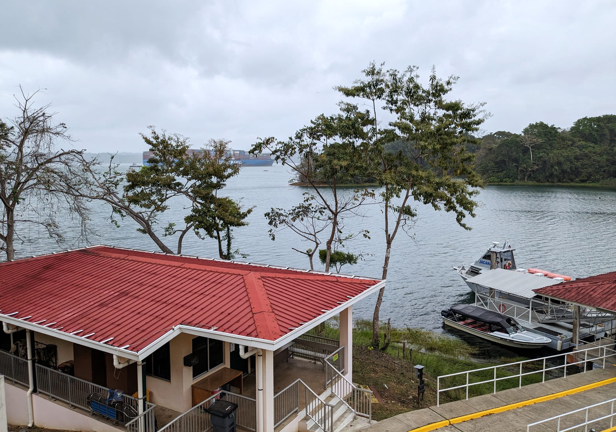
That system runs the canal and provides drinking water, but it’s also part of the larger rainforest ecosystem. Barro Colorado Island (BCI) sits in the middle of Lake Gatun, and it’s a prime example of this ecosystem’s riotous biodiversity. The island is home to 335 species of birds, 35 amphibians, 71 reptiles, 110 mammals (plus 74 distinct species of bats), nearly 1400 species of plants, and so many types of insects that an accurate census is impossible. This abundance of life has been closely studied by the Smithsonian Tropical Research Institute (STRI) ever since the flooding of the canal made an island out of what had been a mountain.
I visited BCI to talk to STRI meteorologist Brian Harvey about one of the challenges inherent in running a canal that relies on natural systems: namely, that its operations are susceptible to drought. As I explained a few weeks ago, Lake Gatun and its complementary reservoir Lake Alhajuela are filled with rain-fed freshwater and are vulnerable to annual fluctuations in precipitation. That vulnerability is evident this year: an El Niño event lowered rainfall, triggering a drought, and the reserves of water are running low. Brian calls El Niño an infamous large-scale oscillation, which is to say it’s a weather phenomenon that breaks into the mainstream and is recognized by us non-meteorologists. He explained it as an index that tracks the sea surface temperatures in the Pacific. The swing in temperature affects ocean winds and currents and cascades through local weather systems; in Panama, El Niño tends to mean less precipitation. That was certainly the case last year, as 2023 marked the second-driest wet season on record.
Erick Córdoba, a hydrologist at the Panama Canal Authority (called ACP for the Spanish acronym), is keenly aware of the challenges posed by the El Niño phenomenon. His team is constantly modeling the lake levels to plan canal operations, and keeps a close eye on the Columbia Climate School’s El Niño forecasting. He says, “We want to be able to make decisions in advance so we can avoid chaos.” Forecasting can determine what conditions are developing 6-9 months in advance, giving ACP some time to plan and prepare for droughts. Erick and his team carefully manage lake levels through the dry season, storing as much water as possible in Lake Alhajuela. It’s deeper than Lake Gatun and has less surface area, meaning less water is lost to evaporation. As the water level drops in Lake Gatun, water is transferred from Lake Alhajuela. All of this work is paired with water-saving restrictions on canal operations; until the next rainy season, the daily number of transits has been reduced, and the maximum draft for vessels is limited.

While drought is the defining story of the Panama Canal this year (as it has been for every El Niño year), others have been characterized by floods that bring a whole other set of problems. In a country where there are two seasons – wet and dry – and water is the engine that drives the most valuable piece of infrastructure, water management is everything.
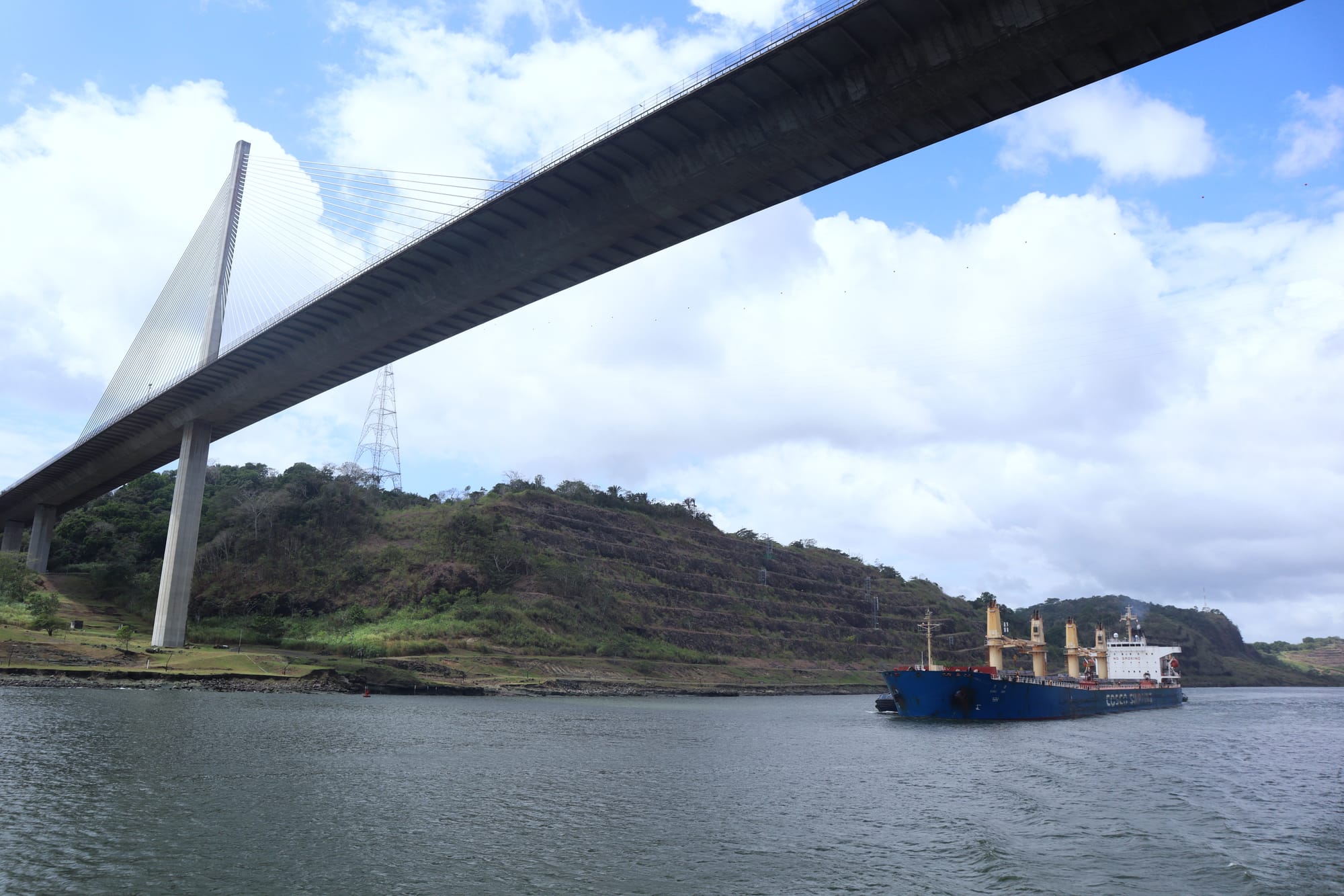
For most navigable canals, the availability of water isn’t much of a concern. The Suez, for example, is a straightforward cut through the desert connecting the waters of the Mediterranean and Red Seas. Since these two bodies of water are at the same elevation, the Suez Canal doesn’t require locks, which are generally used to negotiate a difference in elevation between two bodies of water. The Erie Canal employed 35 locks to step vessels down from Lake Erie, 174 meters above sea level, to the Atlantic Ocean. Both of these canals connect waters that are so vast as to seem limitless (although the water level in the Great Lakes is dropping, and the oceans rising). The Panama Canal is unique in the way its locks bring vessels up to, and then back down from, an intermediate body of water – Lake Gatun – which slowly depletes through the dry season. This, and Lake Gatun’s relatively small size, makes the Panama Canal more vulnerable to annual weather fluctuations: Lake Erie holds nearly 500 cubic kilometers of water, whereas the Panama Canal’s Lake Gatun holds just 1% of that. And because of Panama’s wet-dry seasonality, the water in Lake Gatun must be replenished every year.
Relying on freshwater and locks to operate the canal might seem inefficient, but excavating down to sea level across the isthmus was attempted and (famously) failed miserably. This effort was led by the Frenchman Ferdinand De Lesseps. De Lesseps was neither an engineer nor a financier, but as anthropologist Ashley Carse explains, “He was a promoter, first and foremost.” He was also a diplomat with powerful friends. He had been instrumental in the development of the Suez Canal, securing a key concession from Sa'id Pasha, the ruler of Egypt, in 1854. Once it became clear that the Suez was a success, De Lesseps set his sights on Panama. Despite the mountainous terrain, torrential rain, and unfavorable engineering reports, he would settle for nothing less than a canal that blasted through the mountains and excavated a clear path between the two oceans.
In 1879 he began assembling a company to work on the project and drummed up widespread enthusiasm, public support, and capital. His surveyors found a low point in the mountains, only 64 meters above sea level, and in 1880 excavation began. The difficult terrain gave pause to the engineers, however. At Suez, they had been excavating a desert, and while a tremendous amount of sand needed to be moved, the work was straightforward. Furthermore, there had been no rain to contend with. In Panama, they were blasting through bedrock, managing landslides, and getting battered with rain for eight months of the year. Throughout the rainy season, rivers swelled, washing away equipment and flooding worksites. Enthusiasm and a dream were no match for the landscape. In the most mountainous section of the canal, the Culebra Cut, De Lesseps’ company spent nine years excavating 14 million cubic meters of material – and only managed to lower the summit by five meters.
The truly wild thing is that even if it had worked – even if his company had somehow managed to remove all of the rock and soil necessary to slice through the entire isthmus – the canal still would have been a catastrophe. De Lesseps failed to plan for the consequences of all of that torrential rain. Consider this: his canal would have been a deep and narrow valley, 64 meters deep and 90 meters wide cut through rock and soil. It would have disrupted the paths of rivers, which would then terminate as waterfalls, careening down the newly excavated cliff faces. During the dry season, these waterfalls might be quite pretty, but during the rainy season, they would become treacherous. The most formidable foe would be the Chagres River. Historian David McCullough notes that during the rainy season, it “could rise 10 feet [3 meters] in an hour. At flood stage it could run as much as 36 feet [10.9 meters] deep … and measure 1,500 feet [457 meters] across.” Imagine a wall of water, as wide as the Brooklyn Bridge, barrelling down a cliff; it would be disastrous, filling the canal with rapids, and scuttling any ship that attempted to pass. This is to say that during the rainy season, which is a full eight months of every year, a sea-level canal would make for a fraught passage.
Perhaps De Lesseps believed a solution to these deluges would be forthcoming, but in practice, he simply lied about having it sorted. He claimed the Chagres would be “diverted” into a channel, but no serious work ever occurred. In 1885, five years into the project, he told a reporter that the problem the river posed was at last resolved, declaring, “we have changed the whole course of the river and made it run on the other side of the mountains altogether.” This was not true. By 1888, the project was out of money and De Lesseps ended his career in disgrace.
In 1902, the American government purchased the French company’s equipment and property and renewed the efforts to build a canal in Panama. They devised a plan that enlisted the floodwaters as a key part of the design, and the canal that exists today began to take shape. Instead of ignoring the torrential water that flowed through the wet seasons, hydrologists and engineers married themselves to it, planning to dam the Chagres River and collect its tremendous flow into an artificial watershed that would provide the services needed for all canal operations. Further, moving ships up into the canal greatly reduced the amount of excavation necessary. McCullough again:
The vital factor in the whole plan and all its structural, mechanical, and electrical components—was water. Water would lift and lower the ships. The buoyancy of water would make the tremendous lock gates, gates two to three times heavier than any ever built before, virtually weightless. The power of falling water at the Gatun spillway would generate the electrical current to run all the motors to operate the system, as well as the towing locomotives or “electric mules.” The canal, in other words, would supply its own energy needs.
Working with the Chagres, rather than ignoring its existence, was the shortcut that was needed to create a shortcut between two oceans. The rainforest was flooded to create Gatun Lake as a rain-fed reservoir for canal operations. But even in the beginning, rainfall was unpredictable, and low water levels were soon a problem. As Carse notes, “The canal was less than two decades old when a long drought in 1929 and 1930 raised concerns about the capacity of Gatun Lake to provide enough water for navigation and hydroelectric power generation.” Lake Alajuela (called Madden by the Americans), was dammed in 1935. This year’s drought isn’t unique: Since the canal opened, reservoir levels have been low enough to restrict operations every one year in fifteen.

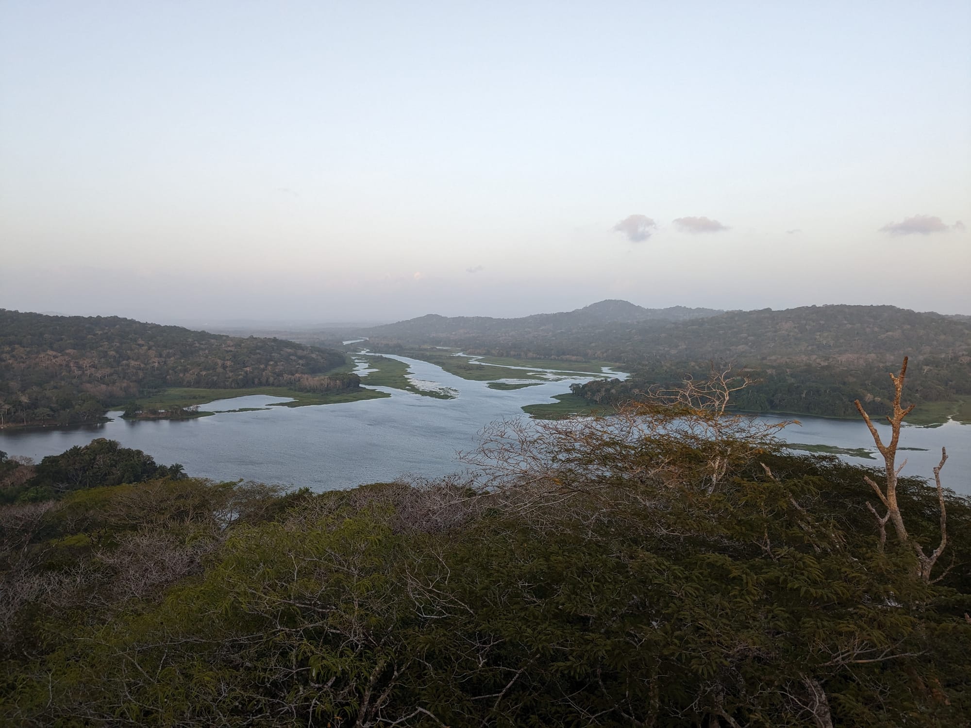
In 1977, another El Niño-related drought prompted a major change in how the surrounding watershed was managed. At a conference on tropical deforestation, scientist Frank Wadsworth presented a paper titled: Deforestation: Death to the Panama Canal. Forests were being cleared for farming, but these plots were susceptible to sediment runoff that filled the lake. Further, rainwater evaporated more quickly from deforested land, so less rainwater flowed to the canal. The Panamanian government soon established two national parks that were, as Carse explains, “oriented toward ‘producing’ water for the canal.” This is to say that forests were protected in hopes of securing enough water for the reservoirs. Scientists at the Smithsonian Tropical Research Institute (STRI) have found that “porous forest soil acts like a sponge, helping trees to store water in the rainy season and releasing water during dry periods.” Increasing forest coverage regulated the flow of water into the canal throughout the year.
Protecting the forests also mitigates flooding. I recently spoke to Jeff Hall, an STRI scientist who oversees Agua Salud, a multidisciplinary research project that investigates restoration in the basin. The team compares water at different sites, including primary forests and degraded cattle pastures. Jeff told me that his team was able to prove the importance of the forest cover to the canal and watershed during a massive flood in 2010. If the forested national park had instead been cattle pasture, an additional 100 million cubic meters of water – 1/7th of Lake Gatun’s full capacity – would have flowed to the Madden Dam, which was already pushed to its full specification. He said, “If that area hadn’t been forested, our data suggests the Panama Canal would have been destroyed.”
As successful as reforestation has been, there doesn’t seem to be any more room to increase water flows through forest conservation. This paper conducted a cost-benefit analysis of ecological investments in the watershed and found that land-use changes alone are not sufficient to avoid restrictions on canal operations. This is to say that while there are other benefits to increasing forest coverage, like carbon sequestration and habitat protection, the gains for water retention have already been made.
I asked ACP hydrologist Erick Córdoba how wet years compare to dry years for him. He said the floods are scary, but while they’re intense and dangerous they’re mercifully short. In contrast, “the dry years are more difficult – droughts last much longer, it’s more painful.” There are no quick fixes to resolve the drought, so Erick and his colleagues face months of challenging work balancing all of the water needs within the canal watershed. The design of the Panama Canal is unique, and it manages to work with rather than against seasonal changes in precipitation. But ACP doesn’t get to dictate those changes. To work with nature is to accept the fact we do not control it – instead, we forecast, prepare, and adapt the best we can.